Day 4,
September 3 … Lake Louise and the Icefields
It is an
absolutely perfect day today. The sky is clear with no haze on the mountains and
the temperature is refreshingly and comfortably cool. We head north up the Trans Canadian Highway
to Lake Louise; however, access is impossible. The parking lots are full --
doesn’t anyone work anymore?! So we
continue north along the Icefields Parkway. Of course the vistas continue to be
the magnificent Rocky Mountains, many of them with glaciers either capped or in
secreted various crevices. We made
several stops along the way …
 |
| Numerous wildlife crossings along the Trans Canadian highway |
Crowfoot
glacier – This
glacier is named for the three smaller glaciers resembling a crow’s foot and is
the first of many glaciers to follow!
 |
| Beautiful Bow Lake |
Bow Lake – This is one of the largest lakes in Banff National Park, fed by runoff from the Bow Glacier. Because the winds were calm, the aquamarine
water of the lake perfectly reflected the deep green alpine forest and Bow
Summit behind it. Amazingly beautiful.
 |
| Peyto Lake |
Peyto Lake – Climbing up to Bow Summit, 7,000 feet, the highest point along
the Icefields Parkway, we find another lake nestled among the mountains and
glaciers; and that is Peyto Lake. The lake is considered the “bluest” of all
the lakes in the park. That color is due to the light reflecting properties of
the glacial flour flowing into the lake from the Peyto Glacier. The view is also
spectacular.
 |
| Mistaya Canyon |
Waterfall
Lake – Yet
another beautiful turquoise lake created by the glacial silt coming from Peyto
Glacier.
Mistaya
Canyon - This necessitated a quarter mile hike, all
down hill on a steep rocky path. But, of
course, the end result was phenomenal.
Water coming down from Peyto Lake gushing through a narrow six-foot
wide, 70-foot deep canyon which it has carved into the rock. The rushing sound of the water is
mesmerizing, the water is icy clear, the smell of the spruce and pines is
intoxicating and the area is pristine. But … arg … the hike by UP the trail can
certainly be considered our workout for the day!
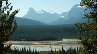
Howse Pass
Lookout – This pass
had been used for hundreds of years by the Aboriginal people to access the
Alberta plains for buffalo. The river here, of course still surrounded by
evergreen forests and tall barren mountain tops spotted with glaciers, looks
like the braided river beds we saw in Alaska.
Very interesting.
 |
| Saskatchewan River |
Saskatchewan
River Crossing – This is a
beautiful braided portion of the Saskatchewan River, which eventually flows
into Lake Winnipeg. It was discovered by British fur traders in 1807 as a trade
route to the Pacific Coast. Because this
particular area gets little snow in the winter, it is an oasis for wildlife.
The overriding views of the evergreens and glaciers in the mountains continues
to enthrall us. It’s also time for
lunch, so we enjoyed our picnic in this very peaceful, beautiful setting –
perfect temps, no wind, no bugs, lots of sunshine and, of course, great
company!!
We pass by
Panther and Bridal Falls, the Saskatchewan Glacier and Parkers Ridge.
 |
| Athabasca Glacier, Columbia Ice Field |
Columbia Ice
Field – The
Athabasca and Dome Glaciers are impressive, and one can even take bus tours to
step out onto the glacier if so inclined.
We simply enjoyed from afar! While the glacier has receded almost a mile in
the past 175 years, it is still a sight to behold. It is almost four miles
long, covers an area of about 2 ½ square miles and is between 300 -980 feet
thick. And the gift shop had some lovely
“Canadian” items for sale too!
 |
| Dome Glacier |
Lake Louise – So all day long we’ve been in this incredible valley of alpines
and mountains, and both Diane and I were snapping pictures practically
continuously at every turn that had a slightly different view point. We probably have enough mountain pictures to
fill an encyclopedia!! Lake Louise held
no exception. The parking pressure
relieved on our return trip, so we left the car in Bob’s capable hands and
proceeded on foot to the shoreline of this magnificent alpine lake. Victoria
Glacier looms at the far end of the lake, about 4 miles away, and is about 300
feet high. It is said when the glacier calves – that is when a piece of ice off
the front of the glacier breaks and crashes into the valley below – the gunshot-like
sound takes 20 seconds before it is heard on the other side of the lake!! Bob and I did reminisce about the last time
we were here 11 years ago. At that time we still had the wherewithal to hike up
the mountain for six miles to the lovely tea house for the best tea we’ve ever
had!! Instead, today we took advantage
of the Happy Hour at a local restaurant/bar.
 |
| Lake Louise with Victoria Glacier in the background |
Moraine Lake – A Canadian icon, this is one of the most photographed paces in
all of Canada. The lake is nestled in the spectacular Valley
of Ten Peaks. Those ten mountains envelope the lake that reflects those peaks
on its glistening, blue green water. The
lake, the alpines, the mountains, the glaciers – simply jaw-dropping. This is
one of the greatest stops!
 |
| Lake Moraine in the Valley of Ten Peaks |
This has
simply been a stunningly beautiful day.
We top it off with delicious Fish and Chips dinners at a local British
Pub , Georgetown Inn … and now we put our bodies to bed – tired but awed by all
we saw and experienced today!


No comments:
Post a Comment